Dr. Michela Gaudiello
Department of African Studies, Polish Centre of Mediterranean Archaeology, University of Warsaw
The first “Polish Archaeological Research in Tigray (PolART)” season in Ethiopia started on 09.03.2020 but because of the Covid pandemic, the archaeological activities ended already on 17.03.2020. The archaeological project focused on the excavation of a Late Aksumite church in Debre Gergis village and in the survey of its immediate environs. Debre Gergis site (in Ethiopic transliteration Däbrä Gərgis) is located in the sub-region of eastern Tigray, about 8 km north from Freweyni / Sinq’ata town, where the team has been settled (Figure 1).
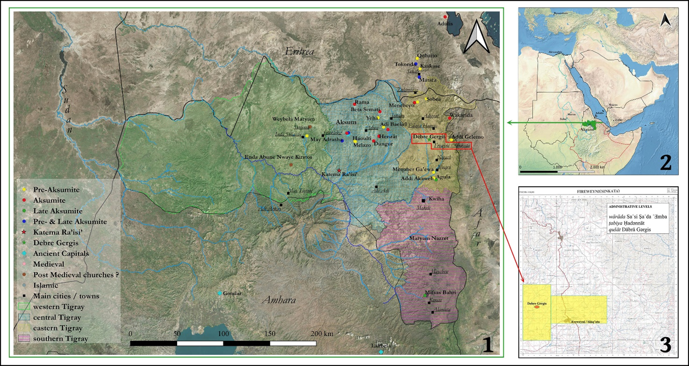 Figure 1: 1. Google Earth image of Tigray Region and most of the known archaeological site (M. Gaudiello); 2. QGIS map of Northeast Africa and South Arabia with the location of Tigray region (M. Gaudiello); 3. Topographic sheet 1:50 000 – 1439 D3 – Fireweyni/Sinkata showing the PolART concession area, Debre Gergis site and Freweyni town (M. Gaudiello).
The archaeological site consists of a mound of ruins 20 x 30 m wide and c. 3 m high. A standing monolithic pillar and 8 fragments of 5 pillars stand obliquely, or horizontally at the top of the mound (Figure 2). Moreover, 150 west of the mound a 6 m high stele dominates the rocky highland (Figure 3).
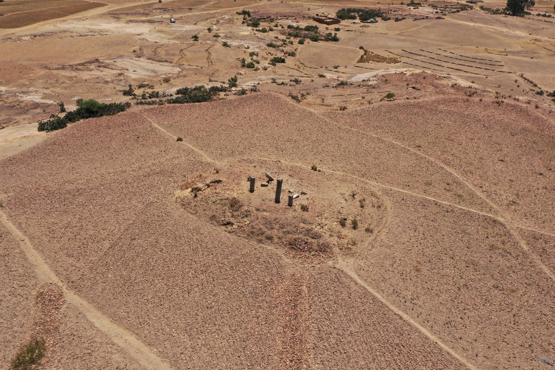 Figure 2: DJI Mavic Pro2 drone image of the mound of Debre Gergis ruins, view to the south-east (© PCMA UW – M. Mackiewicz).
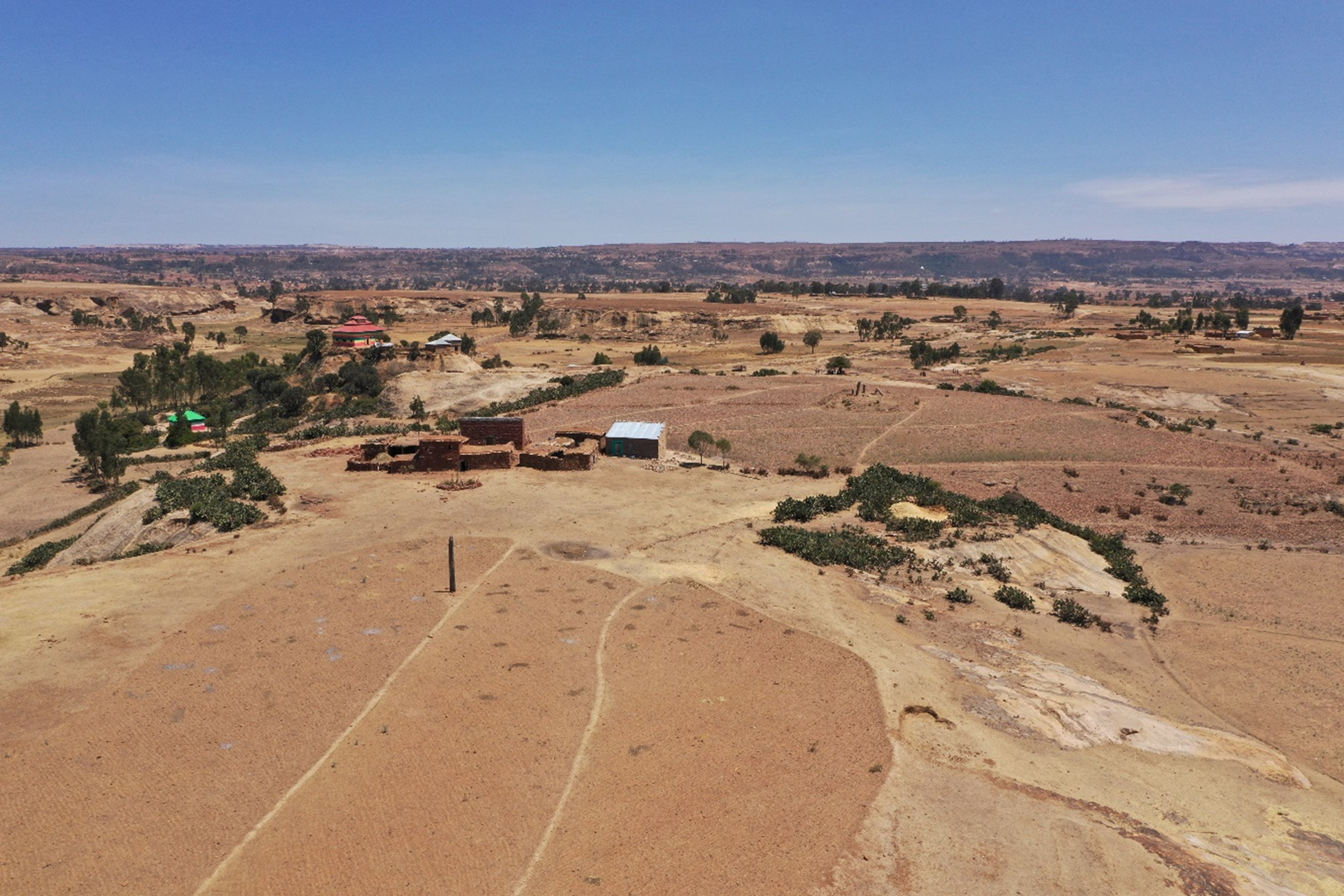 Figure 3: DJI Mavic Pro2 drone image of the stele view to east-north-east and in the background the mound of ruins (© PCMA UW – M. Mackiewicz).
Aim of the first archaeological season was to excavate part of the eastern side of the mound to verify the previous hypothesis that the pillars belonged to a Late Aksumite church (c. 7th century AD) and also to understand the organization of the apsidal sector. Indeed, most of the Late and Post Aksumite churches in Tigray have a semi-circular apse enclosed by two side rooms, while a few are characterised by a tripartite squared sanctuary.
Trench 1 (T1), 11 x 3 m, was set up in the south-eastern side of the mound and we proceeded at the same time cleaning of a dump area dug by one of the landowners and where part of ancient wall was already visible (Figure 4). Therein, Trench 2 (T2), of 6 x 4 m, was laid out. Almost at the end of our season, T1 was extended 1 m to the east, while T2 was enlarged 1 m southwards, in order to connect the two trenches.
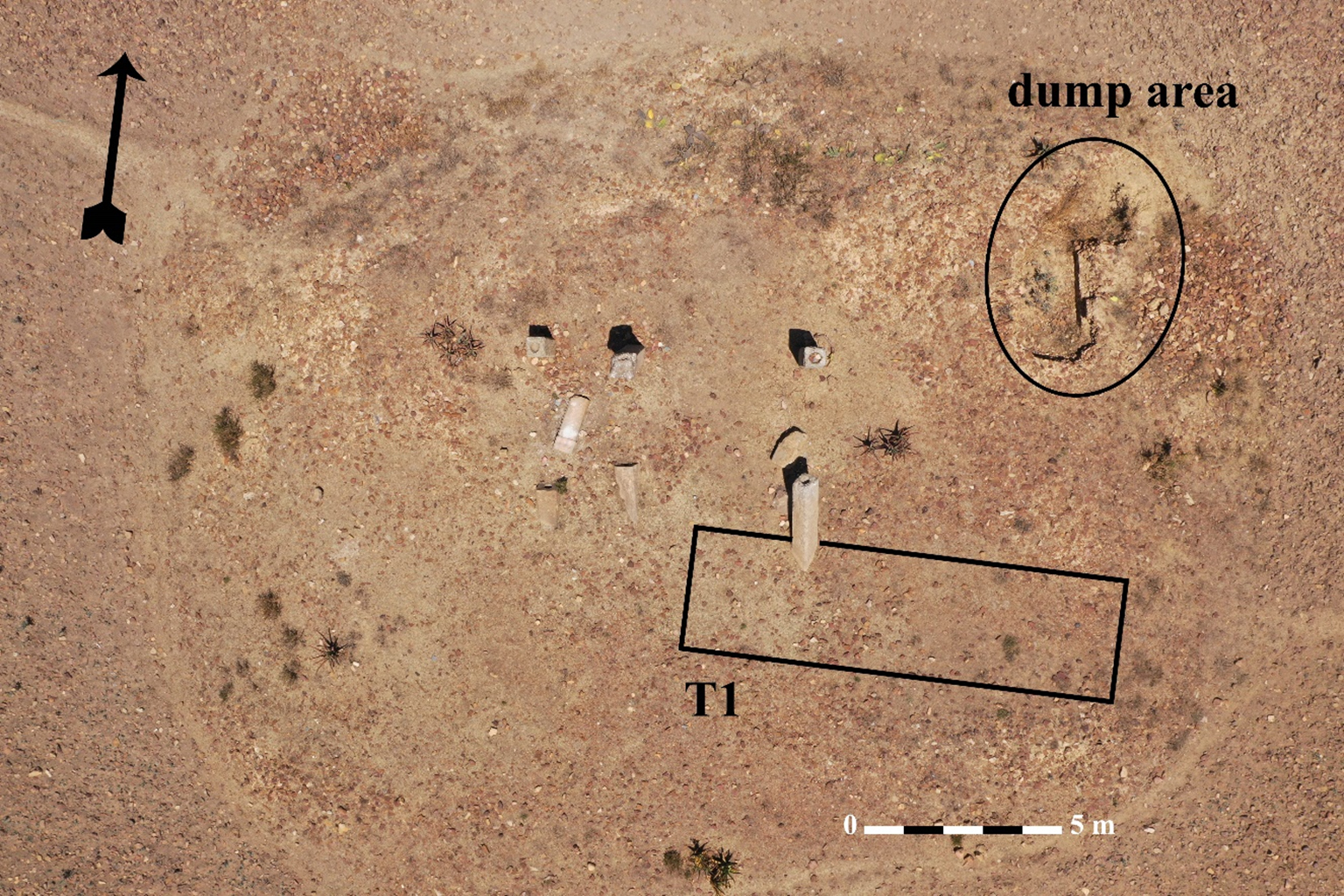 Figure 4: DJI Mavic Pro2 orthophoto image (© PCMA UW – M. Mackiewicz) with the position of Trench 1 (T1) and the spoil area (M. Gaudiello).
T1 has been excavated in three sectors separated by 1 m bulks (T1-E, T1-C and T1-W) and only the last day the easternmost bulk was removed. Immediately below c. 10-15 cm of topsoil, several dressed and grooved stones came to light. Most probably, those stones belong to architectural elements; presumably the grooved stones decorate the basements wall, while the dressed stones their elevation (Figure 5).
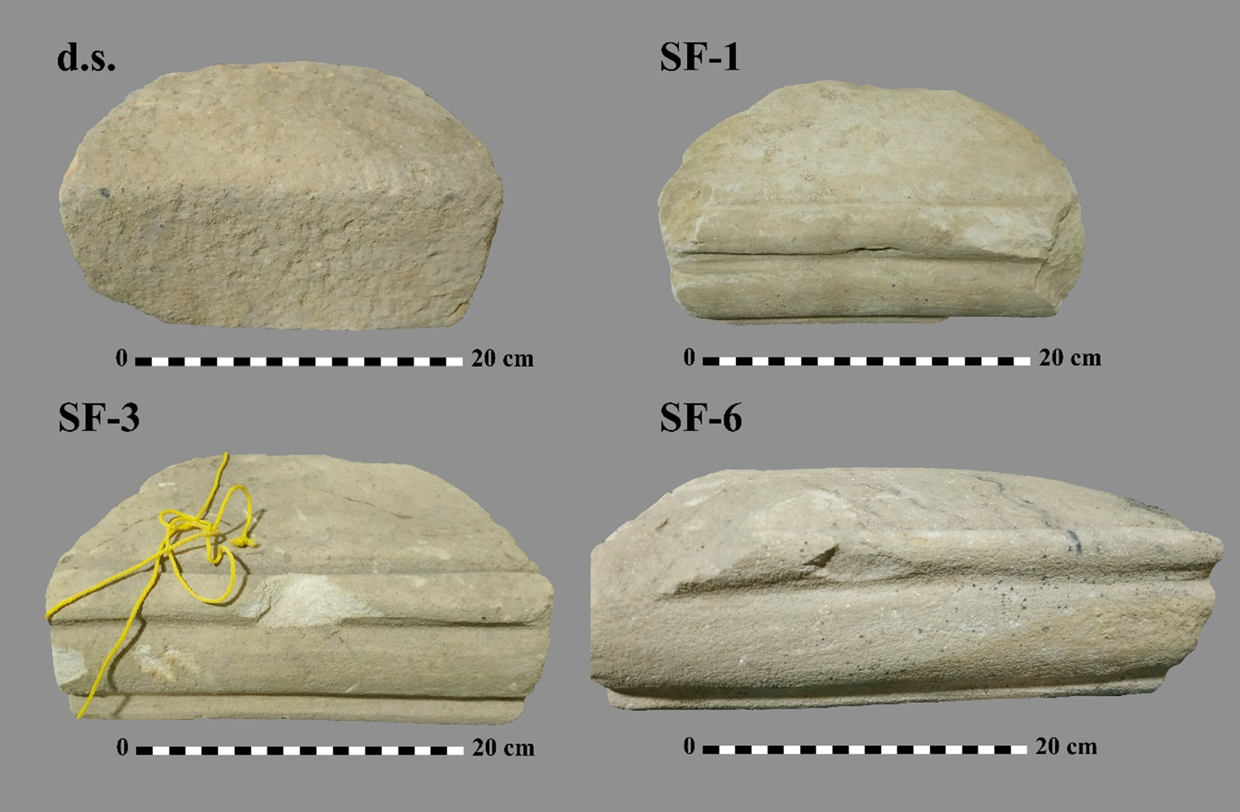 Figure 5: Stones collected immediately below the surface in T1. ‘d.s.’ = dressed stones; ‘SF’ = small finds 1, 3 and 6 are some of the grooved stones yielded from T1 (M. Gaudiello).
The excavation in T1-E revealed part of a subcircular apse, paved with bluish-grey sericite slate slabs and limited by a thin semi-circular wall (c.a. 0.20 m) made of stone. The apsidal sector ends with two steps to the south-eastern side. In the northern section we left large worked stones with squared hollow and carved tenon-like recess in situ, probably a base for wooden frame and poles (Figure 6).
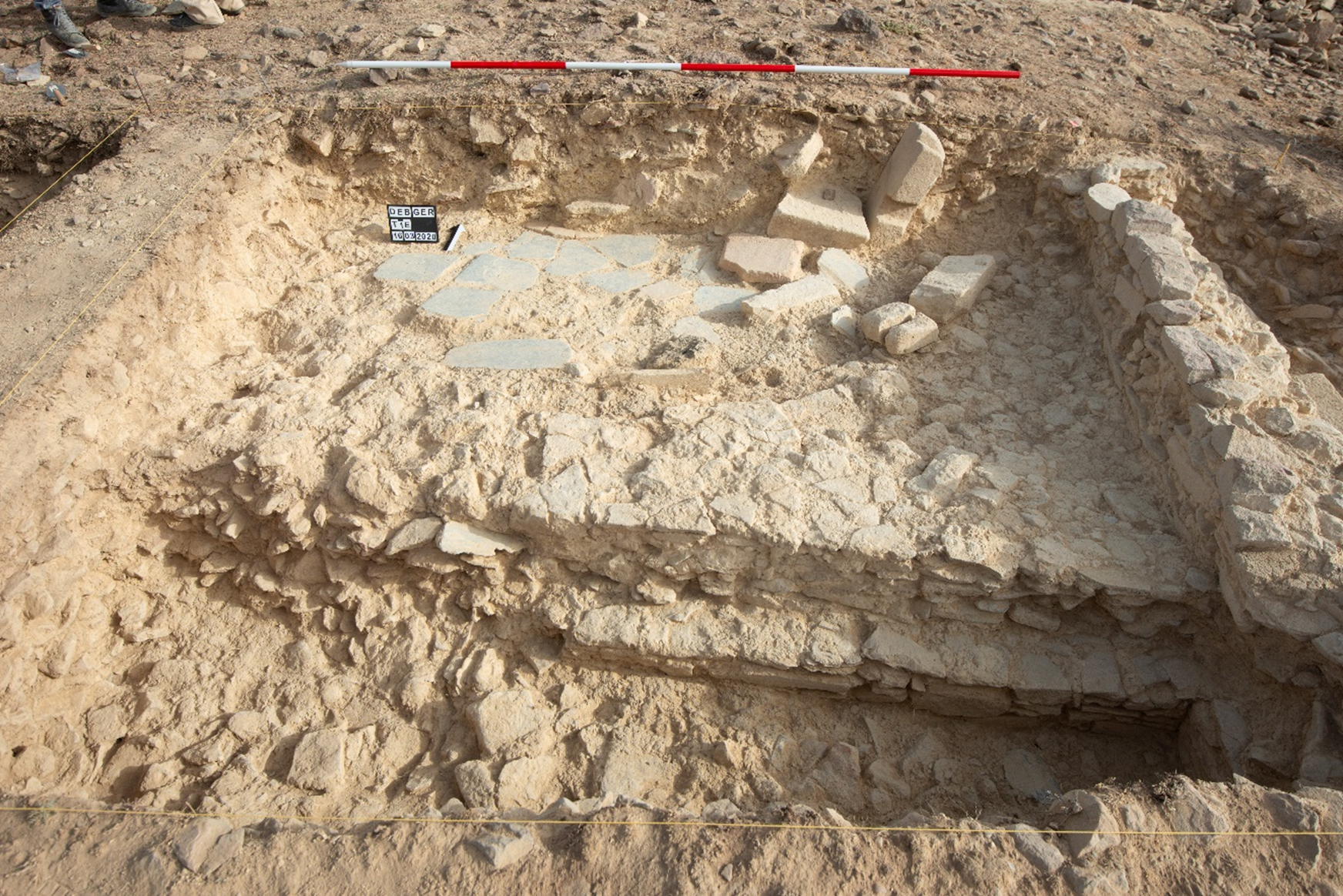 Figure 6: T1-E. Stepped apsidal sector. Bluish schist-slab pavement and worked stones (© PCMA UW – M. Mackiewicz).
Moreover, on the sericite pavement abutting the sub-circular wall (W3) has been discovered a burned base of a sub-rectangular timber pole (Figure 12). The eastern wall of the apsidal sector (W1) was excavated also on the other side when we enlarged T1-E of 1 m eastward. W1 is built in the typical ‘Aksumite style’ characterised by stepped masonry to increase the stability of the wall and shaped with alternate projections and recesses. We exposed the recess for about 2 m, and unearthed the southern projection only in its northern corner. Immediately below the recess the first protruding step came to light (Figure 7). These features of W1 indicate that we have uncovered the eastern external wall of the church.
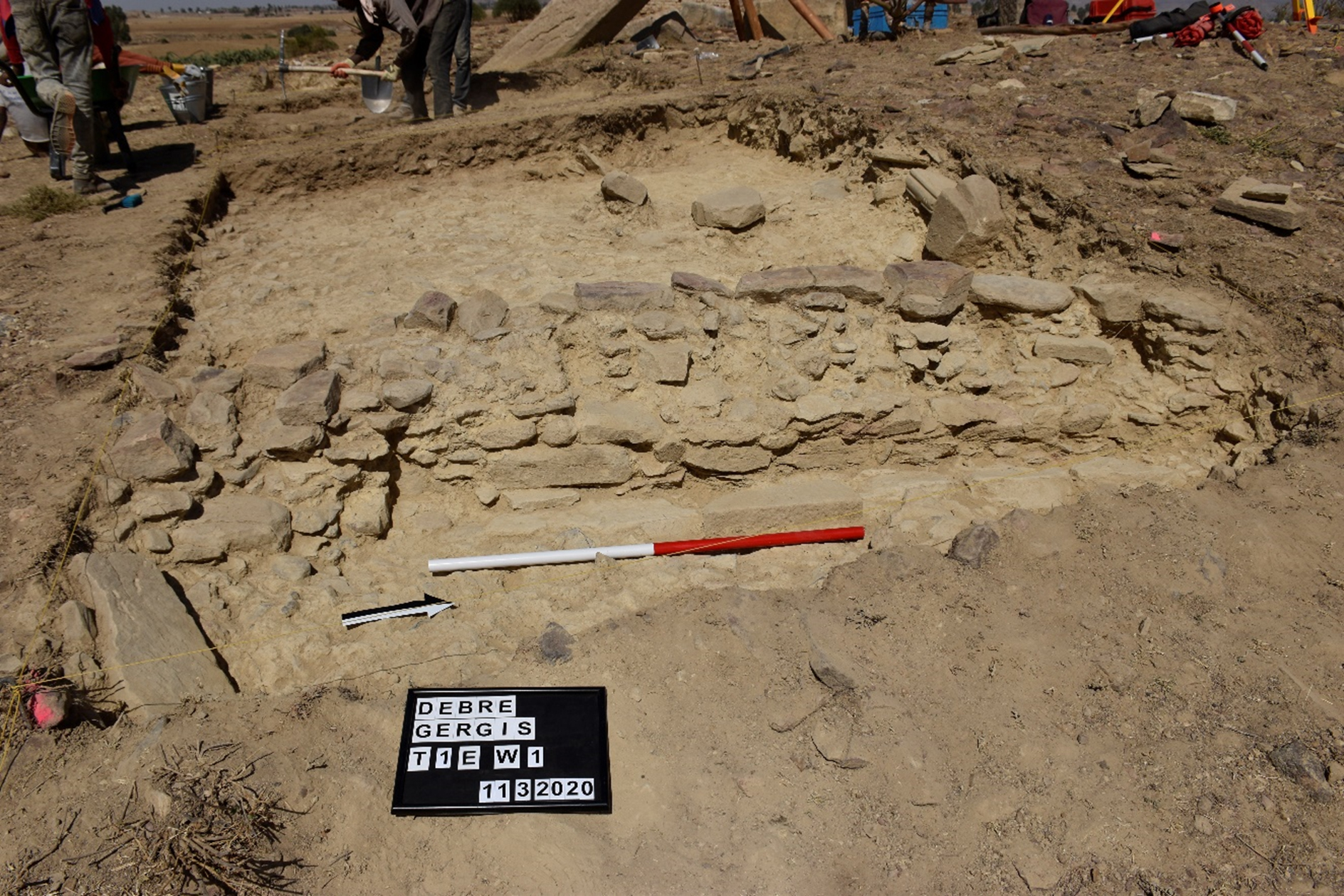 Figure 7: Eastern extension of T1-E. Detail of the indented recess and the corner of projection of the Wall 1 (© PCMA UW – P. Zakrzewski).
In T1-C we excavated and exposed two stepped levels and a bluish-sericite pavement which lays at the same level as the apse floor. A re-used stone, with three carved Ethiopian letters, was embedded between the sericite slabs in the uppermost step (Figure 8). It was possible to discern two letters: the first “K” and the last one “Z”, while the letter in the middle is unclear. In addition, on one side of the stone the letter “M” in engraved (Figure 9).
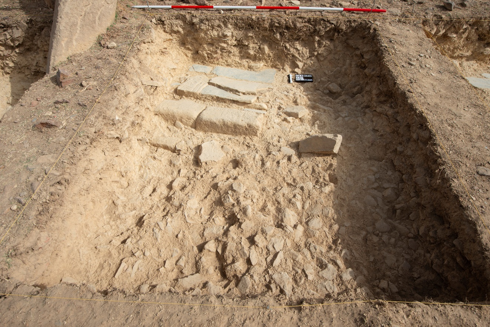 Figure 8: T1-C. Two/three stepped levels, bluish-sericite slab pavement and re-used inscribed stone (© PCMA UW – M. Mackiewicz).
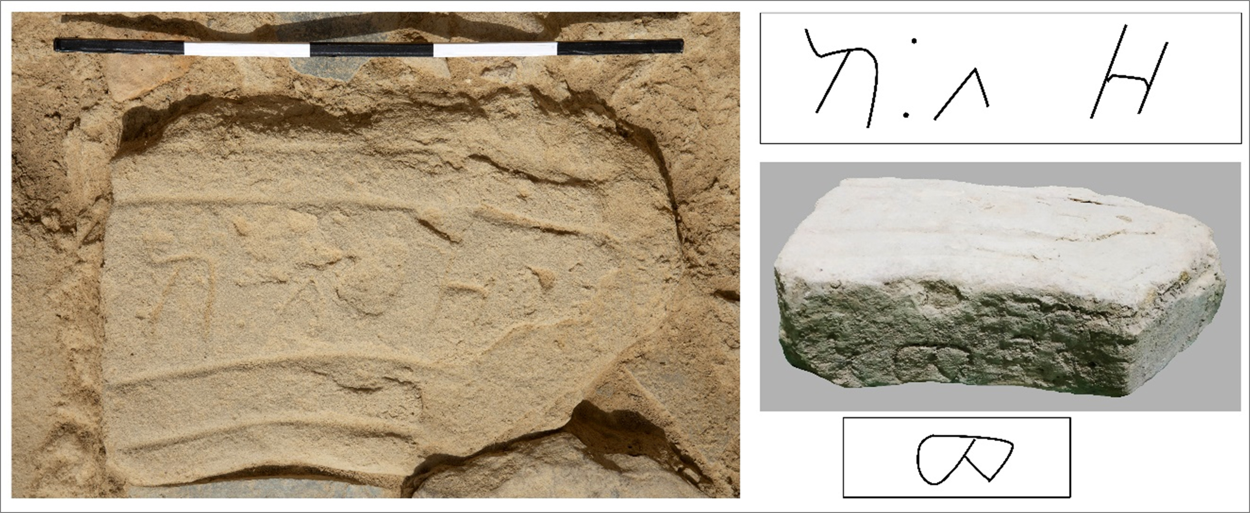 Figure 9: Re-used inscribed stone in T1-C (© PCMA UW – M. Mackiewicz). Drawing of Ethiopian letters and letter carved on the stone side (M. Gaudiello).
The last sector, T1-W, was only superficially excavated, because first of all it was necessary to secure the south-easternmost pillar (no.VI). On the westernmost side we encountered several worked stones, that due their positions seem to be collapsed from the elevation of a wall or a door jamb. Fragments of sericite slabs were slightly visible in the northern part of the trench, while on the southernmost side a piece of burned wooden pillar sloping down in the soil turned up (Figure 10).
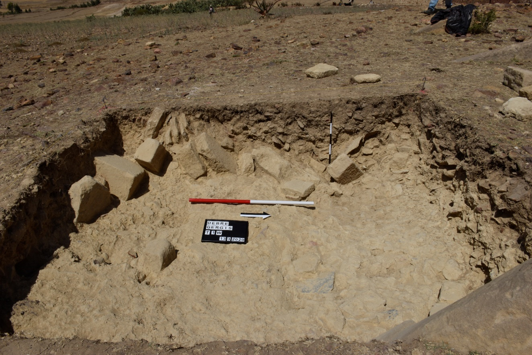 Figure 10: T1-W. Worked stones collapsed from a possible wall or door jamb (© PCMA UW – P. Zakrzewski).
After the cleaning of the dump area, we focused the excavation in T2 to expose the wall already visible (W2) and to determine the direction and shape. During the cleaning of the internal face of W2, in the masonry of the wall elevation we cleared a cavity and pieces of burned timber (Figure 11). Debre Gergis church is built following the typical Aksumite building technique, documented for most of the Aksumite structures: the use of wood beams in the masonry, and the walls (W1, W2 and W3) built with carefully smoothed stone faces and mud and rubble infill. W2 runs in the same direction of W1, of which it seemed to be its northern continuation, and it abuts W4 (Figure 12). This latter has been only partially exposed, in the lower stone rows of the internal face (Figure 11).
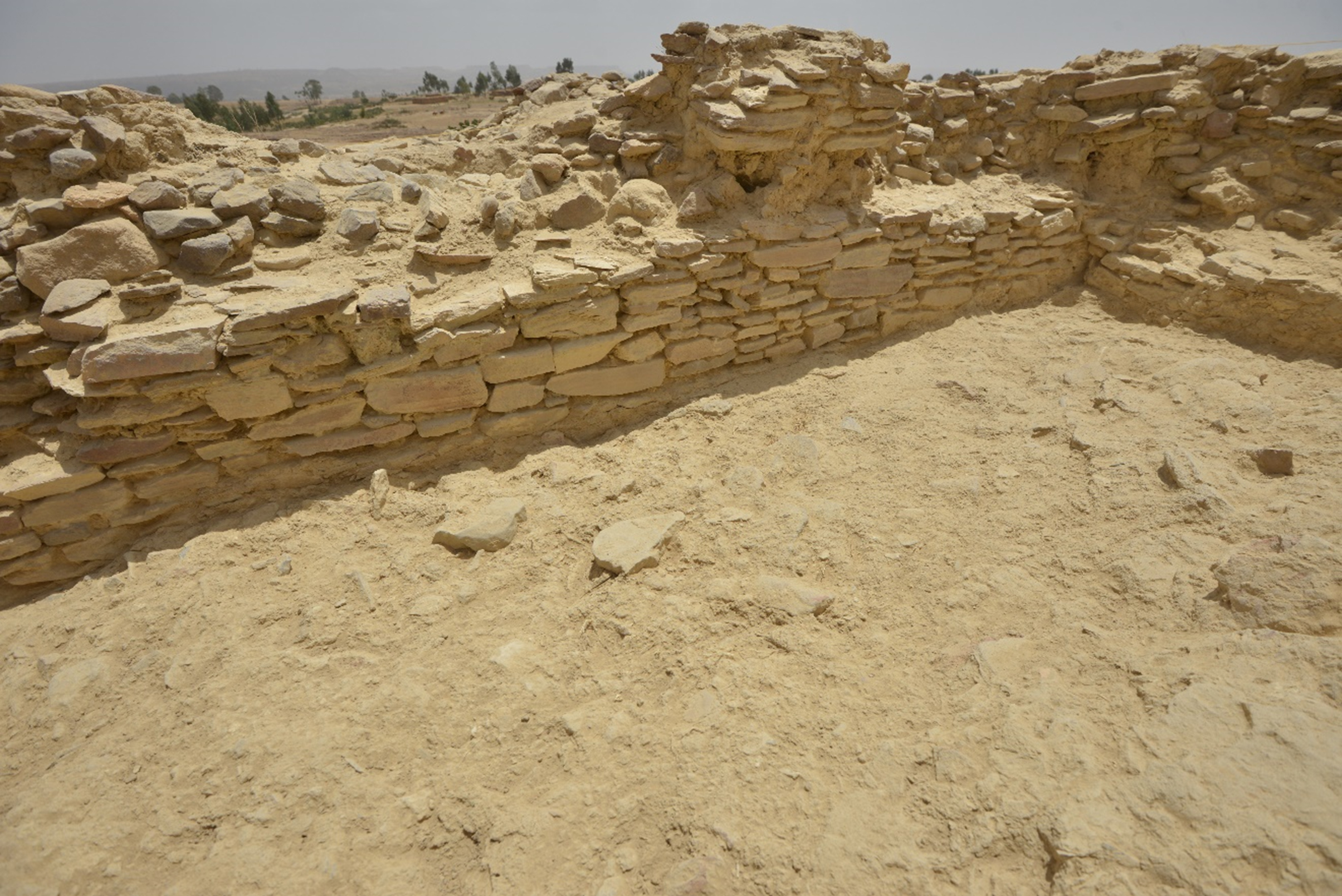 Figure 11: Room in T2 limited by the walls W2 and W4. Detail of W2 masonry with the empty space in wall elevation where the fragments of burned wood has been discovered. (© PCMA UW – M. Mackiewicz).
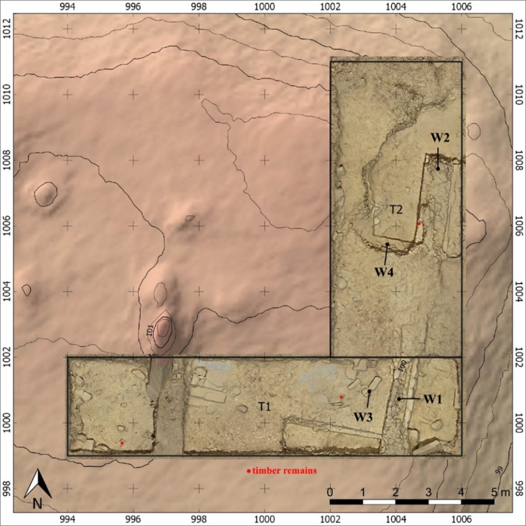 Figure 12: Photogrammetric reconstruction of T1 and T2 and archaeological evidences (© PCMA UW – M. Mackiewicz). Identification of the walls and location of the timber remains (M. Gaudiello).
At the time of the excavation, a field walking survey was conducted in the immediate environs of Debre Gergis archaeological site (DGS_0) in order to record and map further archaeological contexts and to describe the geological and landscape situation, of which the Debre Gergis is part. By virtue of potsherds, knapped lithics and ground stone tools (grinding stones and pestles), occurred during the survey, 9 new possible archaeological sites were recognised and mapped. Moreover, two rock shelters with blurred coloured spots on the surfaces were recorded independently as DSGO_1-2 (Debre Gergis Survey Observation) (Figure 13).
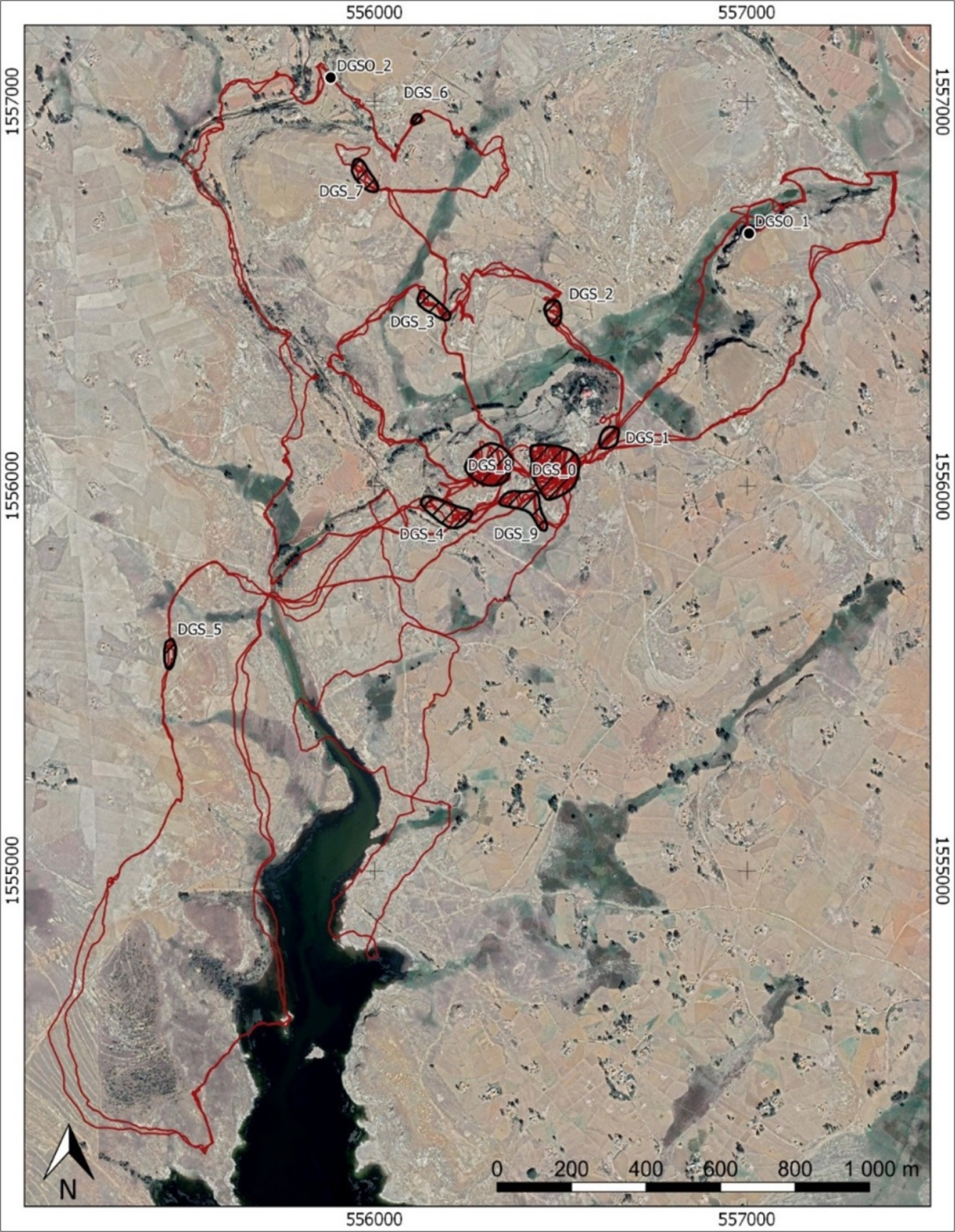 Figure 13: Map of archaeological sites recorded during the field walking survey. The red line represents the surveyors’ tracks (© PCMA UW – M. Mackiewicz).
The decorrelation stretch technique was applied to understand the possible meaning of the coloured spots. Although we took only a few general photos of the entire rock shelter surface and no detailed zoomed photos, we were still able to recognise in the red spots the representation of oxen with short and long horns. Unfortunately, the missing of more detailed photos did not enable us to read clearly the inscription that overlaps the ancient painting, as well as to interpret the bluish spots (Figure 14).
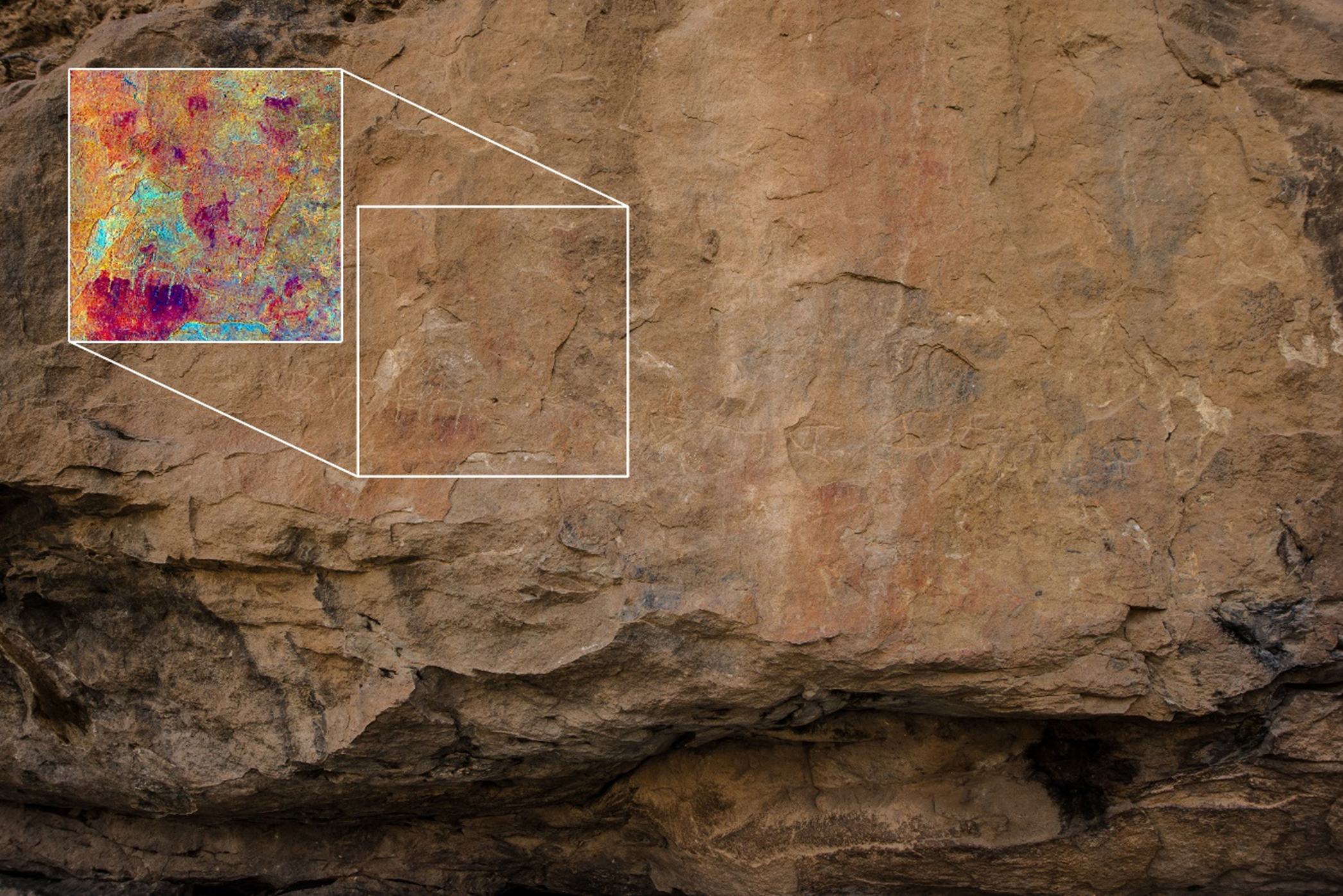 Figure 14. Rock shelter DGSO_1 as it appeared to the surveyors, with the slightly coloured spots and the incised inscription (© PCMA UW – M. Mackiewicz). In the small square the result of the application of the decorrelation stretch technique (M. Mackiewicz).
Finally, time sufficed to video record the stele and the area all around the mound of ruins by means of the drone for the restitution of the 3D photogrammetric models and the Digital Elevation Model of Debre Gergis site, which will be published soon in the PCMA website.
We are planning for future seasons:
- to complete the excavation of the apsidal sector and to dig the area of the pillars to understand the plan and organization of the central nave of the church;
- to analyse all the archaeological materials collected and not documented;
- to prospect the area of the stele and around the mounds geophysically using magnetometry, for subsurface mapping;
- to proceed with the field walking survey and to treat the surface of the rock shelters with the method of Reflectance Transformation Imaging,
However, unfortunately, the current instable political situation in Tigray, due the war which erupted last 04 November 2020 prevents for the time being the planning of future activities at Debre Gergis.
I personally thank to the Ethiopian authorities, Authority for the Research and Conservation of the Cultural Heritage (ARCCH – Addis Ababa) and Tigrai Culture and Tourism Bureau (TCTB – Mekelle), who provide the permission to start the first Polish archaeological project in Tigray and Mekelle University that supported and co-participated in the PolART project. My warmest thanks go to the Debre Gergis villagers who tirelessly worked at the excavation and understood our necessity to leave immediately the country. They rapidly backfilled the trenches and erected a stone wall to protect the site.
